What is the Saba Kaido?
In the days when overseas travel was by sail, and overland travel was on foot,
there existed a network of roads linking the ancient capitals of Kyoto and Nara to the once bustling seaport of Obama, Fukui Prefecture.
These roads later became collectively known as the Saba Kaido, or “Mackerel Highway,” as they were used primarily
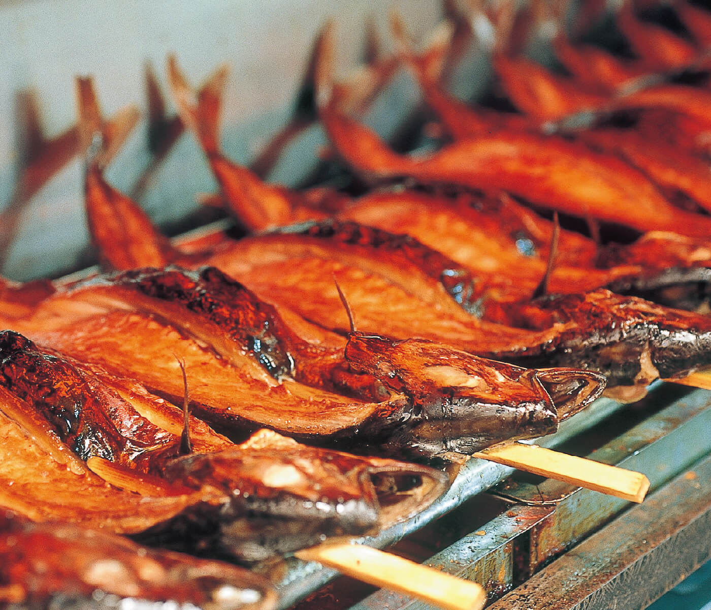
for transporting salted mackerel, salt, and other seafood items harvested from the bountiful fishing grounds of the Wakasa Bay.
there existed a network of roads linking the ancient capitals of Kyoto and Nara to the once bustling seaport of Obama, Fukui Prefecture.
These roads later became collectively known as the Saba Kaido, or “Mackerel Highway,” as they were used primarily
for transporting salted mackerel, salt, and other seafood items harvested from the bountiful fishing grounds of the Wakasa Bay.
History of Saba Kaido
Where the present meets
the past
But the Saba Kaido was more than merely a highway connecting the former capitals to the sea. It connected cities to villages, commerce to culture, and - when the port of Obama served as a principal gateway to the Asian mainland - it connected this remote island nation to the outside world.
These roads served as a conduit for ideas, beliefs, innovations, and aesthetics that would help shape Japan’s complex culture over the centuries. Buddhist statues, pottery, technology, books, and even an elephant were once transported along the old Saba Kaido.
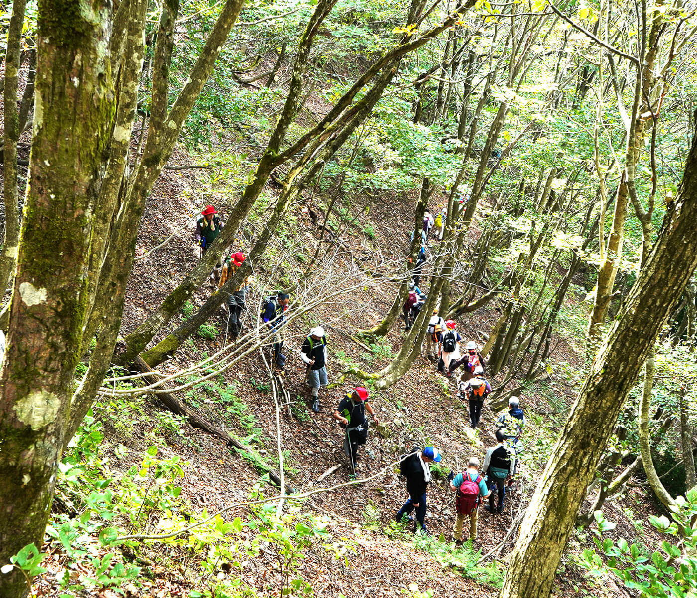
Nowadays, the Sabakaido has become a road that connects the present to the past. To walk it is to step back in time. Peel away layers of history as you go, and glimpse what it may have been like in simpler times, when the landscape was animated by myth and the only means of communication were the roads and the people who traveled them.
These roads served as a conduit for ideas, beliefs, innovations, and aesthetics that would help shape Japan’s complex culture over the centuries. Buddhist statues, pottery, technology, books, and even an elephant were once transported along the old Saba Kaido.
Nowadays, the Sabakaido has become a road that connects the present to the past. To walk it is to step back in time. Peel away layers of history as you go, and glimpse what it may have been like in simpler times, when the landscape was animated by myth and the only means of communication were the roads and the people who traveled them.
The Saba Kaido
A two-way street
Porters would hoist baskets of salted fish onto their backs and hurriedly relay them over steep passes and down into narrow valleys, to arrive at Kyoto’s Demachiyanagi market by the following day.
But the Saba Kaido was not just a one-way street! Conversely, the refined culture of the capital also made its way back through the villages and post towns that had sprouted up along the highway, and helped shape the culture of Obama in ways that are still apparent today. The town’s architecture, festivals, dialect, temples and cuisine are all reminiscent of old Kyoto.
But the Saba Kaido was not just a one-way street! Conversely, the refined culture of the capital also made its way back through the villages and post towns that had sprouted up along the highway, and helped shape the culture of Obama in ways that are still apparent today. The town’s architecture, festivals, dialect, temples and cuisine are all reminiscent of old Kyoto.
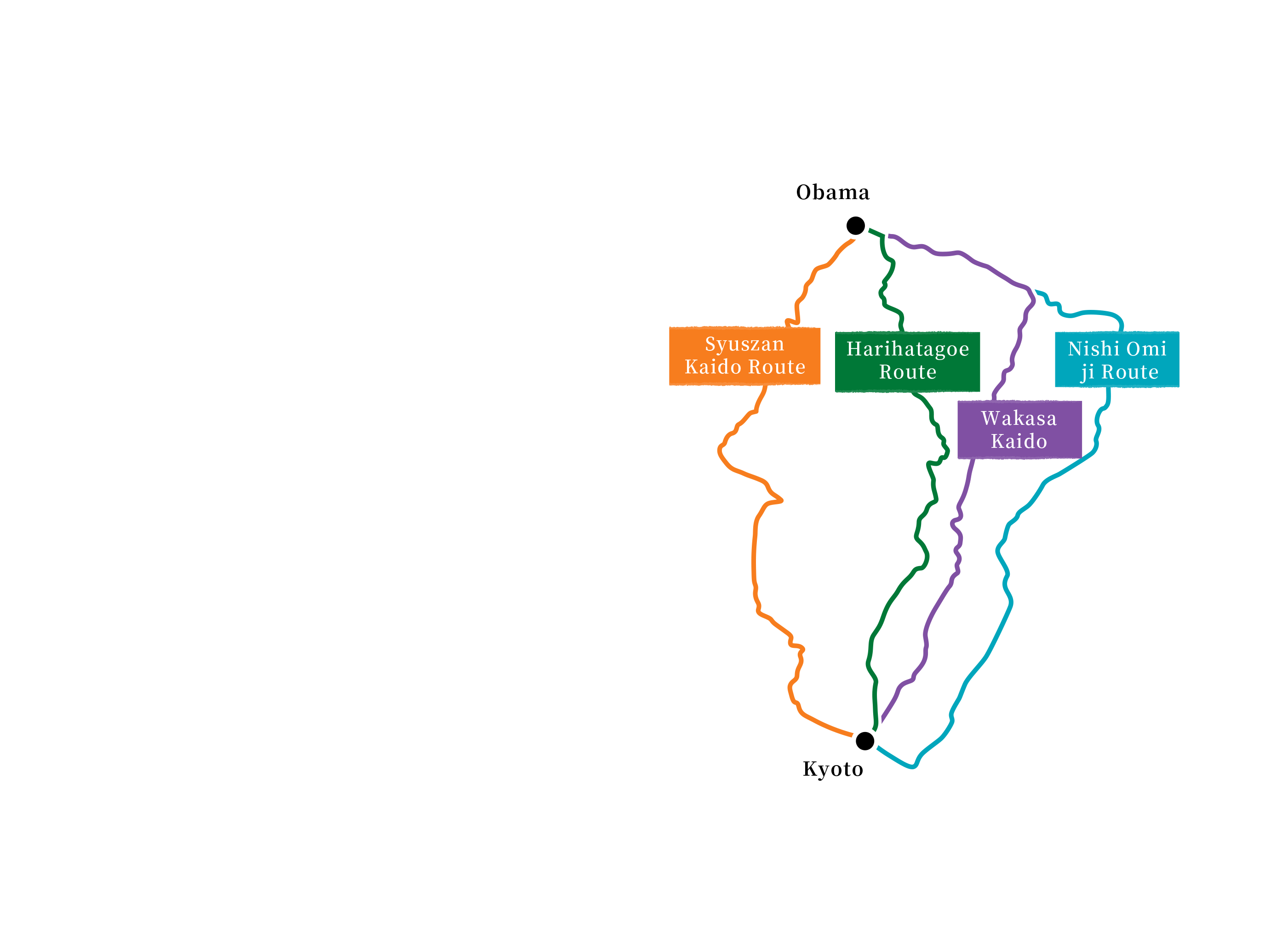
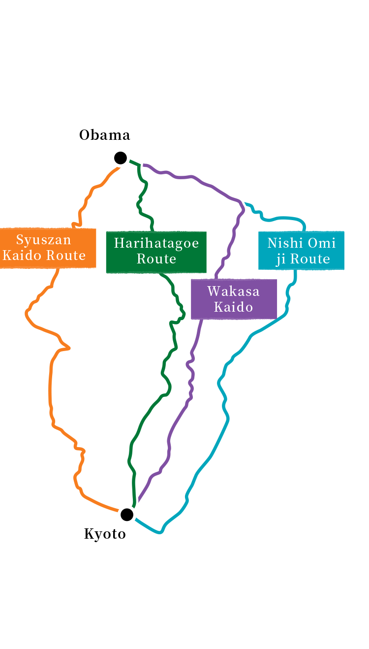
Routes of the Saba Kaido
The Saba Kaido is not a single road, but a network of roads that contains many routes. The main routes are the Wakasa Highway (Kutsuki route), over which the most goods were carried, the Nishi-Omi Road, which passes along the western shore of Lake Biwa – and at one time incorporated boats – and the Harihatagoe Route, which connects Wakasa to Kyoto in the shortest possible time. Being the most direct route, the Harihatagoe was also the steepest, and thus the least accessible by car. For this reason, several segments of the Harihatagoe route remain in their original state, while the other routes have been largely paved over. This is the recommended route for hikers and cyclists.
This site will provide you with information and resources necessary to plan your own journey along the historic Saba Kaido.
This site will provide you with information and resources necessary to plan your own journey along the historic Saba Kaido.